Earthquake Hazards Program

Generate a 3D Slab Model

This web application is used for generating a 3D slab model following the procedure of Hayes et al., 2018. If using models generated from this web application, please cite Hayes et al., 2018 and Haynie et al., 2020 (AGU abstract). Instructions for plotting the model results can be found in the USGS Slab Models plotting documentation . For more information, refer to the Tutorials and the USGS Slab Models GitLab repository.

To generate a slab model, please enter your email address, select a slab region (refer to the map on the right), choose if you would like to model the surface to the top of the slab or the center of the slab, and lastly choose the USGS Slab Models database you would like to use for creating your model. Once submitted, the form will refresh and you will receive an email.
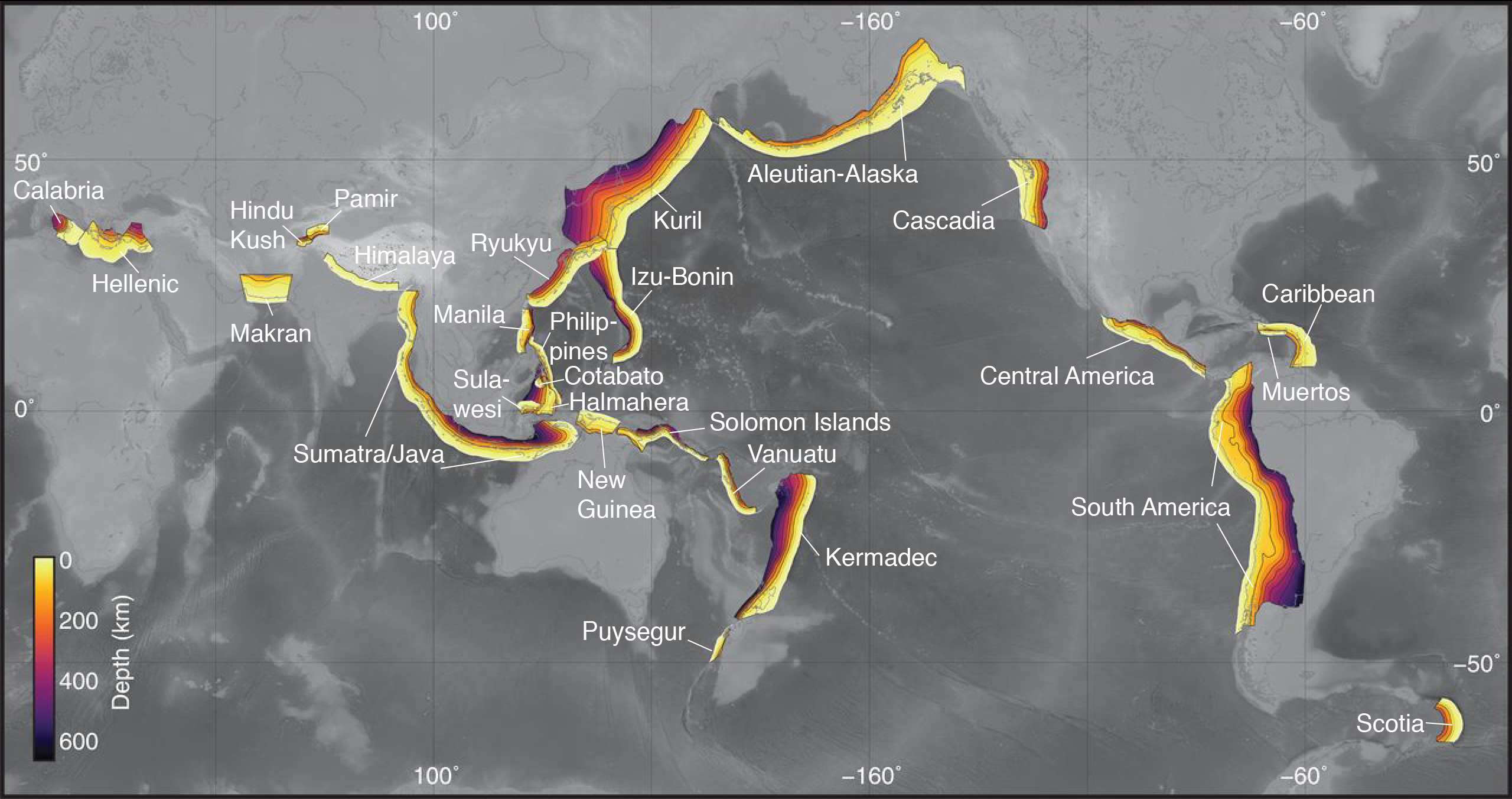
slab2 map
Global distribution of USGS Slab Models colored by depth to the slab surface. Figure modified from Hayes et al., 2018.
The model output will be emailed to this address This is the subduction zone you would like to model Choose between the option to model the surface to the top of the slab or the surface to the center of the slab. Select a database that will be used for creating your model. The 2018 database corresponds to the published Slab2 models from Hayes et al., 2018. Databases after that were updated to contain earthquakes from the ComCat and global CMT catalogs from each previous year (i.e., dates specify the most recent event date).

Once submitted, you will receive a confirmation email. Results will also be emailed as a zip file within one hour.

usgs.gov

official website of the U.S. Department of the Interior

Looking for U.S. government information and services?  Visit USA.gov