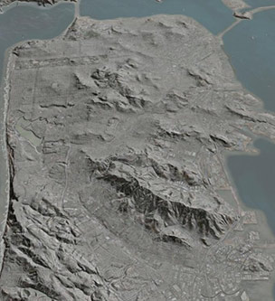
Hillshades
Shaded relief, or hillshading, is a technique where a lighting effect is added to a map based on elevation variations within the landscape. It provides a clearer picture of the topography by mimicing the sun’s effects (illumination, shading and shadows) on hills and canyons.
Google Earth File
This layer depicts hillshades for the entire bay area.
Hillshades(6 kB)
Learn More
- Data source (7.5 Min DEMs)
- Data source (National Elevation Dataset)
Google Earth software enables you to zoom in beyond the level of accuracy provided in these data layers.