Did You Feel It? (DYFI) collects information from people who felt an earthquake and creates maps that show what people experienced and the extent of damage.
Report it Here - Tell Us!
Find the earthquake you felt, and then tell us about it. Not in the list?
DYFI, Past 24 Hours
- IIM 2.0 - 21 km NE of Primo Tapia, B.C., MX2025-04-05 08:46:31 UTC1 responses
- IM 0.9 - 21 km ESE of Anza, CA2025-04-05 08:08:09 UTC1 responses
- IIIM 1.7 - 12 km ESE of Yountville, CA2025-04-05 07:35:58 UTC1 responses
- IM 1.6 - 9 km NE of Healdsburg, CA2025-04-05 06:41:19 UTC1 responses
- IIIM 2.8 - 4 km N of Stanton, Texas2025-04-05 04:09:40 UTC5 responses
- IIM 3.1 - 0 km NNE of Guánica, Puerto Rico2025-04-05 03:18:13 UTC1 responses
- IIM 2.8 - 17 km SE of Naalehu, Hawaii2025-04-04 23:43:53 UTC2 responses
- VM 6.9 - 194 km ESE of Kimbe, Papua New Guinea2025-04-04 20:04:38 UTC9 responses
- IIM 4.6 - 24 km WNW of Imabetsu, Japan2025-04-04 19:15:42 UTC1 responses
- IIM 1.8 - 26 km NNW of Susitna, Alaska2025-04-04 15:41:10 UTC1 responses
- IIIM 2.9 - 13 km NNE of Pittsburg, CA2025-04-04 15:37:40 UTC31 responses
- IVM 4.7 - 7 km W of Kyaukse, Burma (Myanmar)2025-04-04 15:25:24 UTC6 responses
- IIIM 3.3 - 34 km WNW of Elfin Cove, Alaska2025-04-04 14:36:36 UTC1 responses
- IM 2.2 - 13 km NNE of Pittsburg, CA2025-04-04 14:34:45 UTC0 responses
- IVM 4.9 - 32 km ENE of Dailekh, Nepal2025-04-04 14:22:50 UTC15 responses
- IIM 1.9 - 5 km SSW of Frazier Park, CA2025-04-04 13:31:08 UTC2 responses
- IIIM 4.0 - 13 km NNW of Hualien City, Taiwan2025-04-04 13:12:03 UTC2 responses
- IM 2.7 - 36 km NNW of Toyah, Texas2025-04-04 11:58:33 UTC2 responses
- IVM 5.2 - 53 km S of Madang, Papua New Guinea2025-04-04 10:51:48 UTC4 responses
- IIIM 2.1 - 5 km W of Arcadia, Oklahoma2025-04-04 09:44:35 UTC2 responses
View Map and List of Felt Events
Search and View Past Earthquakes
-
Search DYFI Archives
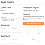
Explore events that include DYFI. Default search retrieves only events with DYFI products from the past 30 days but can be refined to user specifications.
-
Explore the Science Behind DYFI
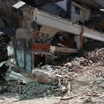
Explore our collection of citizen science data, report your experience of an earthquake, or learn more about this citizen science project - how it's done, how you can contribute, and what we do with your data.
-
Visualize Yearly DYFI Data
Cumulative and yearly response maps for earthquakes in the U.S. and around the world using an interactive map. Export a map view using the printer icon in top left corner of map.
-
Discover Related Products
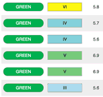
DYFI is one of many products that work together to tell a more complete story. Explore products related to DYFI.